Categotry Archives: Black History

by

The Year Without A Summer

Categories: Abington, Abolitionists, Archives, Black History, Death, Documents, Quakerism, Warminster

Charles Kirk

Charles Kirk (1800-1890)

In 1816, the Northern Hemisphere experienced a summer so cold that lakes and waterways were frozen in parts of Pennsylvania in July and August and frost was reported as far south as Virginia. Crops were destroyed by frost at the peak of the growing season, leading to widespread food shortages. In Ireland, the famine was compounded by an outbreak of epidemic typhus, a lice-borne illness that is more prevalent in colder weather because lice can hide more easily within multiple layers of clothing. Scientists now believe the world was experiencing a volcanic winter caused by the eruption of Mount Tambora in Indonesia, the largest eruption in 1,300 years. This disastrous year was called the Year Without A Summer.

The experience of one Bucks County resident serves as a microcosm of this global disaster. In 1879, Charles Kirk (1800-1890) of Warminster composed a series of autobiographical reflections, beginning with his childhood in Abington. One of the first stories he recounts is that of his family’s struggle during the Year Without A Summer. Frost struck throughout the summer months, and like so many other farmers they were left without a harvest. In October his family suffered an outbreak of typhus, which claimed the life of his mother Rebecca and his sister Ruth and afflicted all of the other children besides Charles. His father was already physically disabled due to prior injuries, so at the age of fifteen Charles was forced to assume a heavy burden for his family. He recalls:

The year 1816 was a very eventful year to our family for it was the coldest summer ever in the County, frost in every month. I remember well of seeing in the Sixth Month, of the leaves on the hickory trees dead and crisp by the effects of it. Crops very light indeed. Scarcely any corn came to maturity, enough for to be fit for seed. For several years before and after this time owing to the poverty of the farm we were nearly always out of hay before the grass was cut to turn out a pasture, and out of grain before the next crop came to maturity. These things used to nick me to the very quick, for I was so ashamed to be seen hauling hay in the spring of the year to feed our stock that I disliked to meet anyone for it seemed to manifest to my mind a want of industry and management, but I have lived to see that even this kind of schooling, hard as it was to bear, has had its good effects on my mind.

I now come to the most sorrowful period of my life. In the latter part of the summer of this year my dear Mother was taken sick with what was then called typhus fever, and after about nine days suffering her trials, hardships and her anxieties came to a close in this world and I fully believe she entered into a state of happiness in the next. But here I must pause, for I have no words to convey the feelings of my mind on that occasion, for although more than sixty-two years has passed since that event, still the remembrance of it is clear and strong, so much so that I scarcely refrain from shedding tears whilst writing these lines. There was ten children of us at the time, the youngest about five years of age.

The time of my Mother’s sickness was an anxious one to all the family for she was indeed the head of it in every sense of the word. The fever at that time was thought to be contagious so us children were not allowed to go in the room where she was, but there was a crack in the board partition in the garret stairway that I used to go and peer through to see her. These are the last sights I ever had of her in this life. One day during her illness when out in the field reflecting on the prospect of things the impression on my mind was that if she should die there would be no pleasure left for me in this world, but I had not then learned to look to a higher Power for peace and happiness, the great fountain and source of all good, the sure foundation to build upon in this life.

It was indeed a house of affliction. Sister Ruth took the fever and was dangerously ill for a long time so much so that we were called in more than once to see her die, but after a long and tedious time she recovered. Sister Elizabeth, a girl about twelve years old, sickened and died with it in the 18th of 10th Month, 1816. The rest of the children all took the fever, eight of them sick in bed at one time. I was the only one that escaped and I well remember feeling so thankful for the favor. The neighbors became alarmed, some were afraid to come amongst it but still there were some who rendered every assistance in their power. As I was the only one able to go, there was much that fell to my lot to do at that time. The doctors depended almost entirely on stimulants, wine and brandy was used in large quantities, and I had also to go round and to solicit persons to come and set up with the sick, and even this was a lesson of instruction to me and I have endeavored to profit by it. Never when any of the neighbors were sick not to be sent for but to go and see if I could be of any use.

Source: Charles Kirk’s Journal (handwritten copy), Bound Manuscript Collection, BM-B-243, Mercer Museum Library, Doylestown, PA.

Although the Kirk family continued to face financial difficulty in the years that followed, Charles eventually became a successful farmer. In about 1841 he purchased a 118-acre farm in Warminster Township, and the 1870 US Census values his combined real estate and personal estate at $18,500. He became a respected elder in the Society of Friends, and he participated in the Underground Railroad, sheltering a fugitive from Virginia named Sarah Lewis for more than a decade after slave hunters captured the rest of her family in Philadelphia. Although little trace of his farm remains, having been purchased by the US Navy as part of the Johnsville Naval Air Development Center in 1994, Kirk Road still bears his name. A house that was once part of Kirk’s farm is still standing, currently the home of Gilda’s Club Delaware Valley, a cancer support group. According to the Pennsylvania Historic and Museum Commission, the structure dates to 1817, so it very well may have been the house where Charles Kirk composed his memoires.

Note: The portion of Charles Kirk’s diary excerpted above has been edited for readability. Punctuation has been added for clarity, capitalization has been normalized, and minor spelling errors and slips of the pen have been corrected.

The version of Kirk’s narrative found in the Mercer Museum Library’s manuscript is apparently a transcription of the original text. The book was first used as a record book for public vendues held in Newportville, Bristol Township, in 1841. It was repurposed by a later owner to record genealogical information about the Kirk family and to transcribe the journal of Charles Kirk. This later section is composed in two unique hands, indicating that one person began transcribing Kirk’s journal and a second person completed it. The section excerpted above includes the work of both authors.

by

The Forgotten “Negro Burying Ground” at Middletown Friends Meeting

Categories: Black History, Graves, Langhorne, Maps, Middletown, Quakerism, Racism, Slavery

Negro Burying Ground - Street View

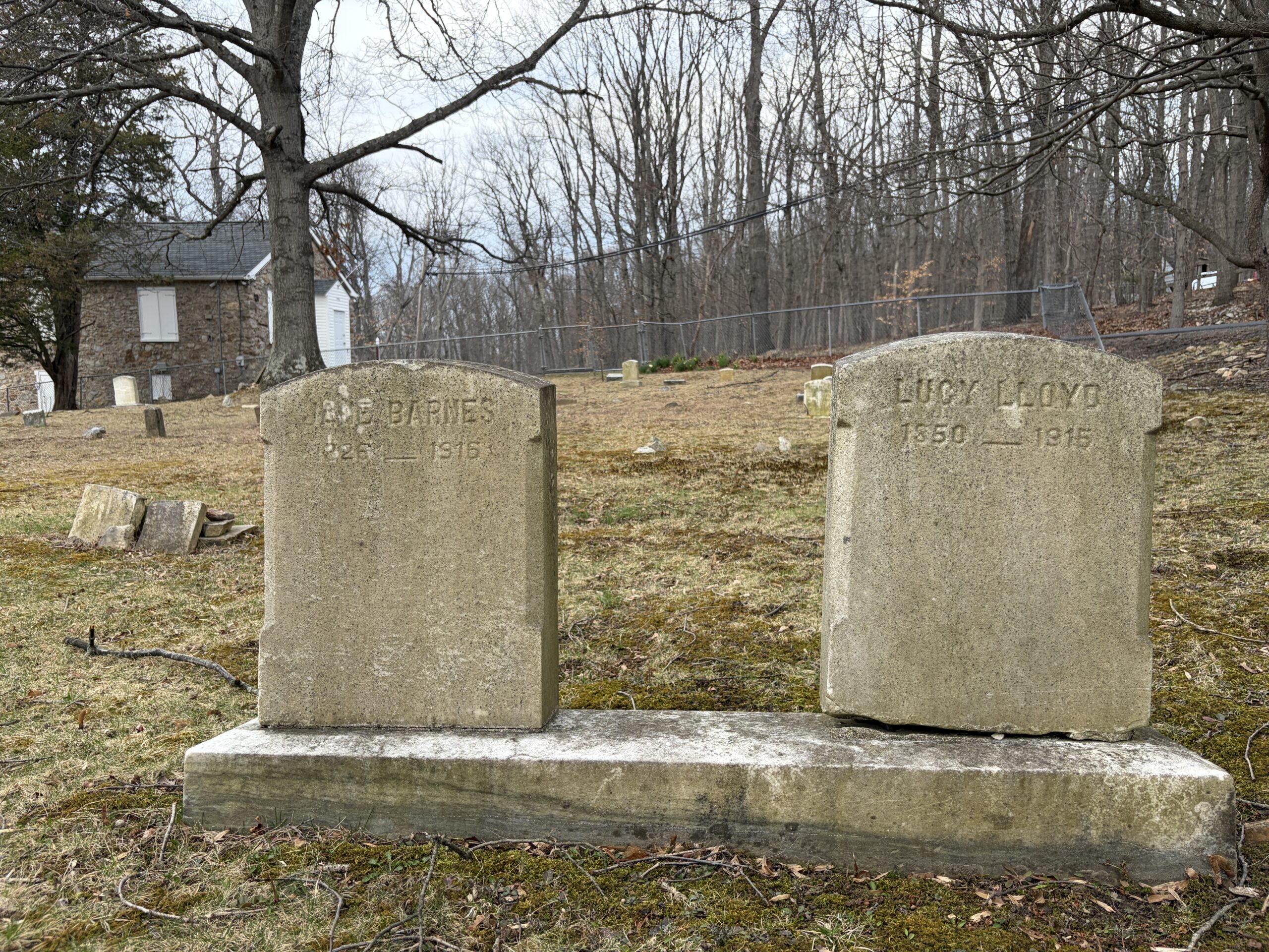
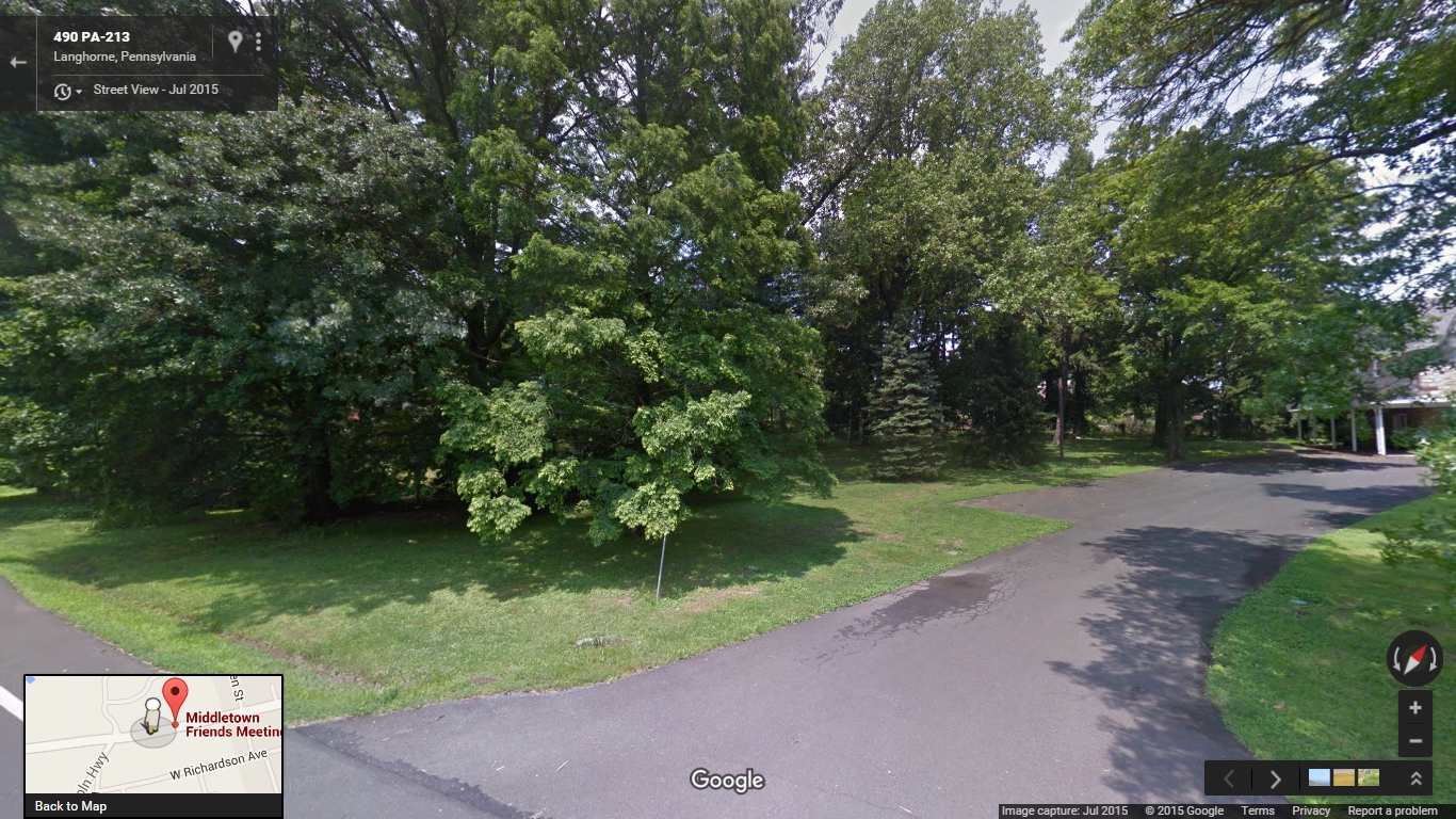
Just southwest of the Middletown Friends meetinghouse lies a small burial ground purchased for the interment of African Americans 225 years ago, at a time when almost a third of the county’s black population remained enslaved. There are no headstones or any other visual indicators to distinguish this plot from the rest of the meeting’s shaded lawn, and like other Quaker meetings in the area, Middletown did not begin keeping burial records until after the Civil War. It is therefore unsurprising that this burial ground has been forgotten in the intervening centuries. The current overseer of the cemetery was unaware of its existence, and while a “Negro burying ground” is referred to in the meeting’s property records, I was not able to identify it’s specific location until I discovered the original deed for the land in the archive of the Friends Historical Library.

Throughout the colonial era, burial grounds were places of great social importance to enslaved Africans. For example, in Philadelphia the section of the Strangers’ Burial Ground (now Washington Square Park) that was set aside for blacks drew large crowds on Sundays, holidays, and fair days. During these gatherings the burial ground became an autonomous African cultural space where participants came together to perform African dances and to speak and sing in their native languages. This was not the case in rural Bucks County, where the small scale of slaveholding meant that the enslaved had few opportunities to interact with other Africans. Slaves were permitted to attend the fairs that were held twice each year Bristol, but only on the last day.

Records indicate that early Quaker settlers initially permitted the burial of Africans in their burial ground, but this was quickly curtailed. Middletown Monthly Meeting, located on the western border of Langhorne Borough, set aside a portion of their burial ground for blacks in the early 18th century, but the meeting vacillated with regard to their treatment of the African dead. Middletown Meeting segregated their burial ground in 1703, noting in their minutes, “There having been formerly some Negros Buryed in friends Burying Yard which they are not well satisfied with therefore Robert Heaton & Thomas Stackhouse are ordered to fence off that corner with as much more as they may see convenient, that friends burying place may be of itself from all others.” After the construction of a wall around the burial ground in 1734 the Friends reaffirmed their opposition to sharing their burial ground with African Americans, ultimately declaring in 1739, “this meeting having had the Matter under Consideration it is unanimously agreed that hereafter no Deceased Negros be Buried Within the walls of the graveyard Belonging to this meeting, & Adam Parker, Jonathan Woolston & Joseph Richardson are appointed to keep the keys of the Said Graveyard & take Care that none be Buried therein but such as they in the Meetings Behalf shall allow of.” The black residents of Bucks County would not have a dedicated burial ground again until the Society of Friends changed its stance on slavery in the late 18th century.

The acknowledgement by the Society of Friends that participation in the slave system violated their religious teachings also sparked a broader concern about the economic and spiritual well-being of African Americans. After Philadelphia Yearly Meeting banned slave ownership in 1776, they also added the treatment of free blacks to the list of religious queries that their constituent meetings were expected to address. Bucks County Quakers responded by appointing committees to meet with black families, holding meetings for worship for blacks, and eventually purchasing a small plot of land adjacent to Middletown Meeting as a “Negro burying ground” in 1791. This parcel measured sixteen and a half feet wide by 136 feet long, large enough for perhaps a few dozen burials. While the section allocated for blacks in 1703 was almost certainly meant to be used for the burial of slaves owned by members of the meeting, this small lot was purchased for the use of the free black community.

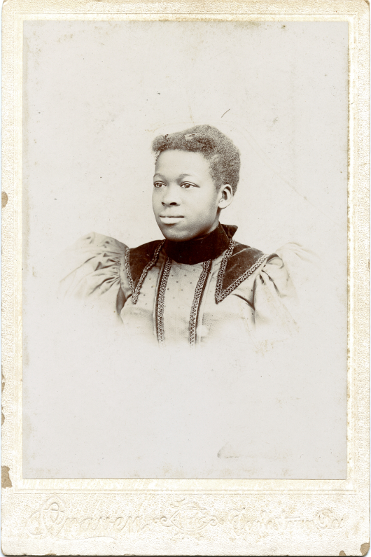
The meeting did not record the burials in this lot and few details about its use remain. The only documented burial that has been identified at present is that of Cato Adams, a free black man who resided in Middletown for a number of years before moving to Bristol. The will that Adams drafted in 1810 demonstrates the burial ground’s importance to the local black community. Although Adams had a number of children and grandchildren to consider when writing his will, he set aside five pounds “for the purpose of keeping in repair the Burying ground appropriated for the interment of black people near to the meeting.” He also left his “first day clothes” to his son. The use of the Quaker term “first day” rather than “Sunday” indicates that he may have attended meeting for worship at Middletown Meeting, although like most African Americans who worshipped with Quakers in this period he was not a member of the Society and does not appear in the meeting’s records. When Adams died in 1812, Orphans’ Court records related to the settlement of his estate show that his executors paid Isaac Gray, a founding member of the independent black Methodist group the Society of Colored Methodists, to dig his grave. The small lot purchased in 1791 was apparently approaching full capacity by 1816, when Middletown Meeting bought an additional lot for the burial of African Americans at the northeast corner of their property along what is now Green Street. This parcel constitutes the northern half of Mt. Olive Cemetery, which was used by Langhorne’s black community into the 20th century. Before the establishment of Bethlehem African Methodist Episcopal Church in 1817 these burial grounds were the only public spaces in Bucks County to which African Americans could claim a collective right.

This slideshow requires JavaScript.

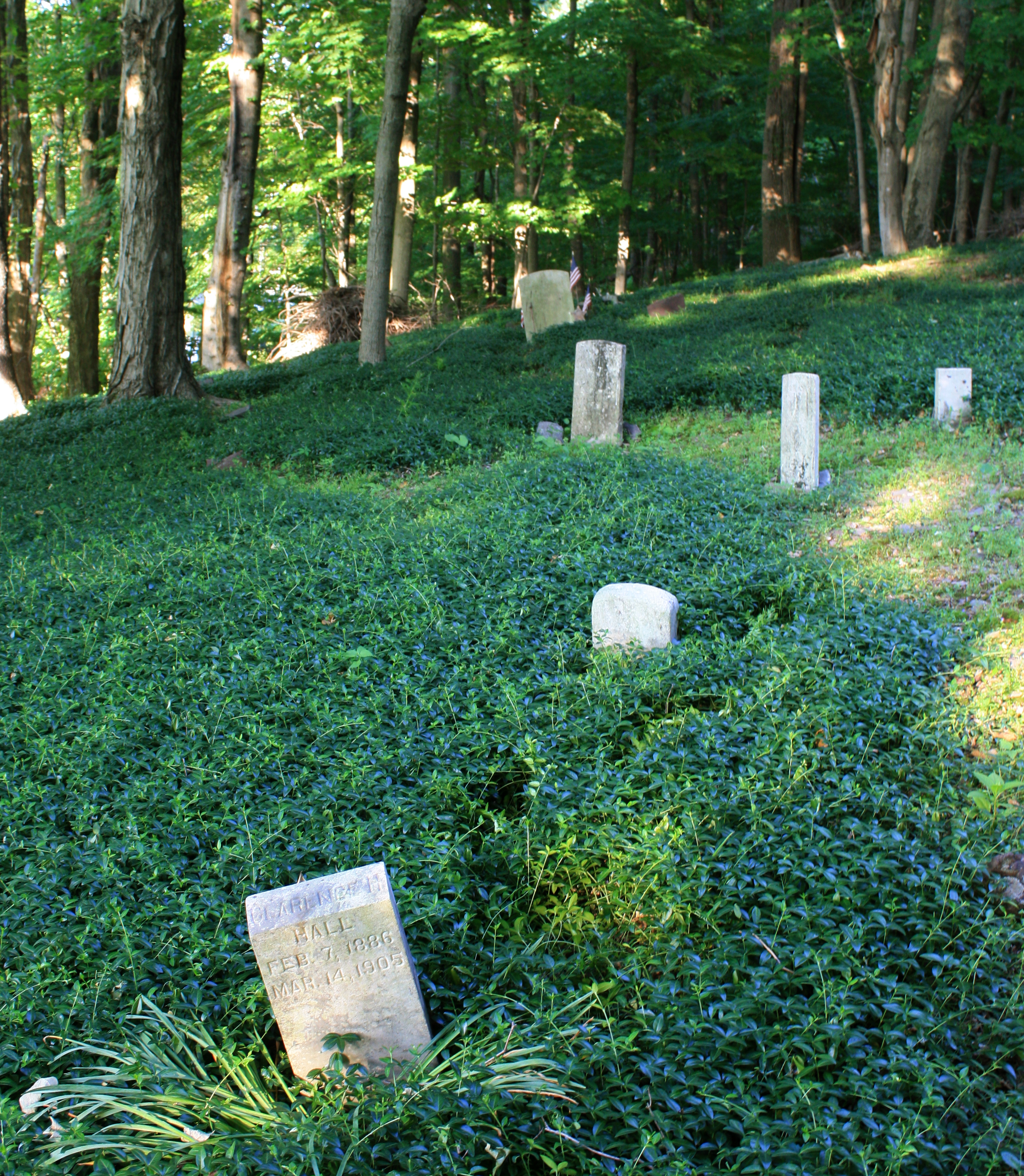
Although evidence is scarce, at least two other African-American burial grounds were created by Quaker meetings in the region. The first was Byberry Preparative Meeting, which established a small African-American burial ground in 1780. This burial ground is now part of Benjamin Rush State Park near the border between Northeast Philadelphia and Bensalem Township, only about four and a half miles away from Middletown Meeting. Joseph C. Martindale provides a brief account of this burial ground in his book A History of the Townships of Byberry and Moreland in Philadelphia (1876):

Previous to this time the colored people who died in the townships were generally buried in the orchards belonging to their masters or in the woods; but forty or fifty had been interred in a kind of cemetery for them, on the lands lately owned by Charles Walmsley. It was located in the field fronting the mansion house, not far from Watson Comly’s line. All traces of it have long since been destroyed, and hundreds have since passed over the spot not knowing that they were treading upon the graves of the long since dead. Another of these graveyards was on the farm lately owned by Mary Hillborn, where several slaves were buried. The exact spot is not now known. Many persons by this time had had their attention drawn to the matter, and efforts were made to secure a proper place for the burial of such people. Accordingly, in this year [1780], we find that Byberry Meeting purchased a lot of Thomas Townsend for a burying place for the blacks, and the practice of burying on private grounds was discontinued. The record says that the first person buried there was “Jim,” a negro belonging to Daniel Walton.

Later, after discussing the local potter’s field where white indigents were interred, he writes:

The graveyard for colored persons… is still kept for that purpose. Some years since a portion of this yard was plowed up, and most of the “little mounds” were leveled with the earth around, so that the exact spot where many of this race were buried can no longer be seen. What a pity that man should ever be willing to disturb the resting-places of the dead in order to add to his coffers! Of late years more care has been taken of this place, and it is now kept in good order by Byberry Meeting.

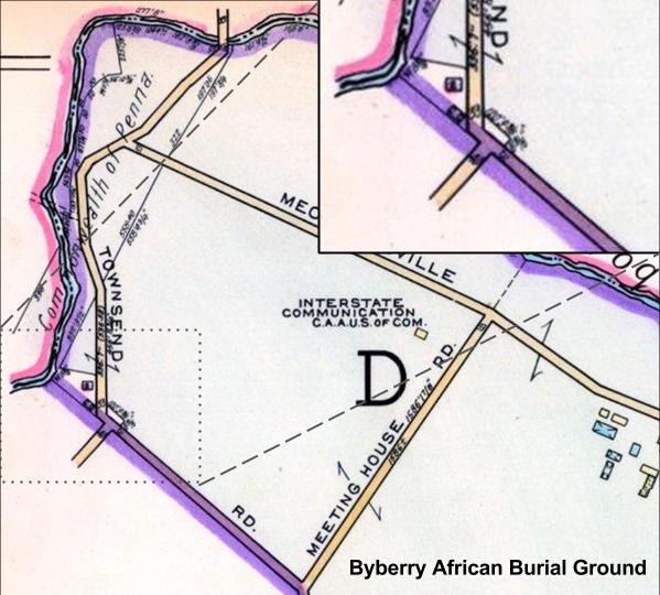
The only historical map that I’ve been able to locate that shows the Byberry African Burial Ground is the “Atlas of Greater Northeast Philadelphia” in Franklin’s Proposed Real Estate Atlases of Philadelphia, Vol. 7 (1953). The small lot is not identified as a burial ground, but the property boundaries are visible:

African American Burial Grounds at Middletown Friends Meeting

More detailed maps, photographs, and other documentation are provided in Byberry Librarian Helen File’s paper on the burial ground and an archaeological study of the site performed by the US General Services Administration in 1993.

The second Quaker meeting in the area to establish an African-American burial ground was Buckingham Friends Meeting, which laid out a small section of their existing graveyard for that purpose in 1807. They report in their minutes:

We have laid out a small portion of Ground within the large Grave Yard at Buckingham to Bury Black People in, Beginning at a stone standing at the North Corner of the Old enclosure, thence N 50 [degrees] E two Perches to a Stone, thence N 40 [degrees] W to a Stone standing at the back Wall of the Yard And to be comprehended by these two lines, the Back Wall, and the Foundation of the Old Wall. The Meeting Uniting therewith, directs Burying in rows beginning at the North End…

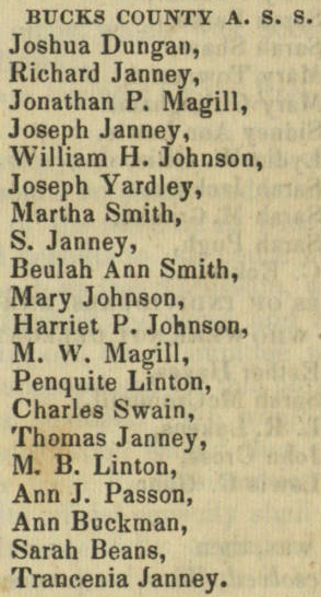
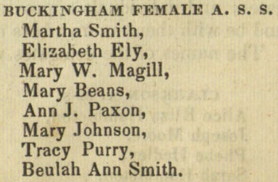
Unfortunately the exact location of this plot is unclear, but it is probably located in the northwest section of the current burial ground. Further examination of the meeting’s property records may yield a more exact location. While the author of the Buckingham Meeting’s National Register of Historic Places nomination claims that “The African American burials here were made unnecessary within a few years” after Mount Gilead African Methodist Episcopal Church was constructed nearby in 1837, a recent archaeological survey of the site conducted by Meagan Ratini suggests that the burials may not have taken place there until the 1860s. If that is the case, the African-American burial ground at Buckingham Meeting may have been in use for half a century.

by

The Burning of Pennsylvania Hall

Categories: Abolitionists, Black History, Buckingham, Philadelphia, Racism, Solebury

The Burning of Pennsylvania HallTonight marks the 176th anniversary of the burning of Pennsylvania Hall, which was razed by anti-black rioters a mere three days after it opened in May of 1838. The building was erected in Philadelphia by the Pennsylvania Anti-Slavery Society, and at the time of the riot they were hosting the Requited Labor Convention, which brought together various regional anti-slavery societies. A number of Bucks County abolitionists were in attendance when the hall was destroyed. The convention minutes list delegates from the Bucks County Anti-Slavery Society as well as the Buckingham Female Anti-Slavery Society. The delegates include people who were very active in the Underground Railroad in Bucks County, including William H. and Mary Johnson of Buckingham and Jonathan P. and Mary W. Magill of Solebury. After the convention was reconvened in September, William H. Johnson was elected as one of the convention’s vice-presidents. The Magills’ son Edward H. Magill would later write the most complete history of the Underground Railroad in Bucks County, “When Men Were Sold: Reminiscences of the Underground Railroad in Bucks County,” published in the second volume of A Collection of Papers Read Before the Bucks County Historical Society.

Bucks Anti-Slavery Society Buckingham Female Anti-Slavery Society

by

Portraits of Black Soldiers from World War I

Categories: Black History, Military, Postcard, World War I

These are post cards, although neither has a stamp so they were never mailed. The first has holes at the top where it was pinned up, presumably by a loved one awaiting the soldier’s return. Based on the uniform, I’m pretty confident it dates to World War I.

Black Soldier WWI Rifle(small)

The second was pretty degraded when I got it, with significant fading and some stains. It was stamped on the back by the photographer, and was taken at Greenfield’s Art Studio, 531 Central Ave, Cincinnati, Ohio. I’m guessing this one is from the same era, although it lacks the distinctive leggings that made me sure about the first one.

Black Soldier WWI Flag(small)

by

Slobbery Run

No comments yet

Categories: Black History, Inns & Taverns, Lower Black Eddy, Places, Plumstead, Racism

The other day I paid a visit to Slobbery Run, a small stream that cuts down from the hillside on River Road and flows into the canal. It wasn’t very slobbery when I came to visit, but I imagine after a hard rain the water flows a bit more impressively through this rocky valley.

From MacReynolds’ Place Names in Bucks County:

Slobbery Run – Small short steam in southeastern Plumstead Township, tumbling through a rocky ravine about a quarter mile east of Lower Black Eddy and emptying into Delaware Division Canal. The water foams over the rough boulders, hence its name. It is a venturesome climb from Delaware River Road up this steep valley, to be paid upon reaching the top with magnificent waves of river scenery.

It’s located just north of Devil’s Half Acre, an unlicensed distillery that operated along the canal in its early days and acquired a raucous reputation. One of the reasons I visited Slobbery Run was to try to pinpoint the plot of land on the boulder-covered hill that a black farmer cleared and cultivated, which I read about in this article by Cyrus Livezy, published in the Doylestown Democrat on November 28th, 1876, and reprinted by MacReynolds in Place Names:

 On the hillside after leaving the old Devils Half Acre house is a modest dwelling erected many years ago by ‘Old Black John,’ who by a vast amount of labor and with more patience and perseverance than is often found in the African race succeeded in rendering a small stony patch susceptible to cultivation, and just beyond this we come to the famous high rocks towering grandly at least eight feet above them. The sun is not visible here and the wintry atmosphere that prevades [sic] this place gives us a taste of that season, and we remember finding a block of winter ice here late April, 1830. Advancing a few rods we pass Rattling Run Cascade and are opposite Moss Giel Rock, which rises from the side of the hill some distance above the road. The ascent is very steep and the distance from the road to the summit of the rock is about three hundred feet. Our fraternal guide offers to lead us up by a circuitous route without difficulty, but climbing steep hills was a favorite amusement fifty years ago, and we resolve to have a taste of it now and in a few minutes, panting for breath, the summit of the rock is reached. Here after resting awhile we contemplate the scenery below, around and far away. On the eastern side is the cascade, so called from a small steam of water flowing through a wildwood glen and over a ledge of rocks. The run formerly bore a name that was rather uncongenial to modern refinement and was changed a few years ago to suit the taste of some Philadelphia ladies; and, although we are generally disposed to accept names as we find them, beg leave to demur on this case (as the steam flows through a thickly wooded glen) to call it Sylvan Run and Sylvan Run Cascade. Moss Giel Rock was dedicated by an ederly [sic] gentleman and some schoolboy companions in 1865, the ceremony consisting of reading Bayard Taylor’s account of the great Burns Festival at Moss Giel in Scotland in 1845. The Broad surface of the rock is smooth and pretty well covered with inscriptions by numerous visitors. Although many years of our life were passed within two miles of this place, we never stood upon the rock before and knew not of its sublimity. To the eastward the head of the Delaware and Raritan Canal feeder, Readings Hollow, Bulls Island and Raven Rock are visible.

It’s amazing to me that, following the rules of politeness in that era, Livezey dances around the word “slobbery” but doesn’t think twice before dropping offensive racial stereotypes.

I didn’t have much luck, and I have no idea if any evidence remains of this old homestead. I looked at an 1876 map of Plumstead, and it seems like the land at the top of the ridge was one large plot, while there were a couple thin strips of separately owned land running between the hill and the canal, one including Devil’s Half Acre and the other with one building shown across the road. It’s possible that John lived there, and that before River Road was widened he had enough cultivatable land to subsist on. I also haven’t been able to identify any African Amercian named John on the Plumstead census records from this era.

UPDATE: I met the owner of what is probably John’s homestead. The old house is gone, but until the 1930’s, it was an old wooden shack raised up on stilts. When the homeowner tore down the house that replaced it (a confused jumble of additions and alterations cobbled together as a residence) to build a new home, the bases of the old wooden stilts were still visible. There’s a small flat area adjacent to the house big enough for a garden.  The other houses immediately past Devil’s Half Acre weren’t built until after World War II, and are therefore unlikely candidates for John’s home site.

The owner of John’s plot also told me that, rather than Slobbery Run, the old-timers used the name Sloppy Gulch.

by

Slavery in Solebury?

No comments yet

Categories: Black History, Racism, Solebury, Tags:

I’m working on a museum exhibit for the Solebury Historical Society that will be on display starting tomorrow. The subject is medical history, and I’ve been researching the earliest doctors in the area. The first recorded in Solebury is Doctor Jonathan Ingham, and I found this interesting note about his death in Davis’ History of Bucks County:

Click to view the full passage on the Inghams from Davis' History of Bucks County.

By this account Doctor Ingham, a resident of Solebury Township, was a slave owner. If Davis is correct, Ingham’s slave Cato is the only recorded slave in Solebury. All other sources I’ve seen claim that there is no record of slavery in the township, and the presence of slaves would have been readily documented. Following Pennsylvania’s Act for the Gradual Abolition of Slavery in 1780, all slave owners were required to register their slaves annually, and if they failed to do so their slaves would be freed. A list of slaves registered in Bucks County is available here. There are no slaves registered in Solebury.

Census data also casts doubt on Davis’ claim. According to the 1790 US Census, Ingham did not own slaves. However, there does appear to be one “free” black person living in his household:

The column “other free persons” can be inferred to mean free black person. However, this “free” person could be an indentured servant. As such, the “other free person” living in the Ingham household could be Cato. While he might not have been legally defined as a slave, he may well have been treated like one.

Slavery and Other Bondage

The 1780 law dictated that all current slaves would remain slaves for life, while the children of slaves would technically be “free” but would remain indentured servants until the age of 28. In theory they had the same rights as a white indentured servant, but their actual position in society was surely quite different. While most white indentured servants willingly entered into servitude, usually being paid with cash or land at the end of their term, the black children born into bondage had no say in the matter. Their terms of service were also much longer. The 28 years of bondage required for these “free” children of slaves was most of their productive life; Davis notes that there are few slaves over the age of 45 in the register and sarcastically suggests, “From this it might be argued that the mild type of slavery in Bucks county was not conducive to long life.”

Conversely, indentured service could be quite profitable for white residents of Bucks County. After Doctor Ingham died his own son Samuel D. Ingham became an indentured servant. Samuel, then 14-years-old, was indentured as a condition of his apprenticeship to a paper miller on the Pennypack. Seven years later Samuel returned to Solebury and took charge of his family’s farm and mills. He was later elected to US Congress and served as Secretary of the Treasury under Andrew Jackson, and lent his name to Ingham County, Michigan.

Clearly indentured servitude meant something different for white residents of Bucks County than for the children of slaves.

by

Her Lips Are Copper Wire

No comments yet

Categories: Art, Black History, Doylestown, Poetry

Jean Toomer

The other night I left work and found State Street abandoned and heavy with wet spring air. Rainwater dripped from the County Theater‘s neon marquee and fog dulled the orange glow of the street lamps. It reminded me of my favorite poem by former Doylestown resident Jean Toomer:

Her Lips Are Copper Wire

whisper of yellow globes
gleaming on lamp-posts that sway
like bootleg licker drinkers in the fog

and let your breath be moist against me
like bright beads on yellow globes

telephone the power-house
that the main wires are insulate

(her words play softly up and down
dewy corridors of billboards)

then with your tongue remove the tape
and press your lips to mine
till they are incandescent

An influential participant in the Harlem Renaissance, his most famous publication is the novel Cane, which compares the experiences of African Americans living in the North and South. He and his wife moved to Doylestown in 1940 and became Quakers. He withdrew from the public eye and remained in Doylestown for the rest of his life. Last Wednesday marked the 44th anniversary of his death in 1967.

by

Springdale, Huffnagle, Rosenthal… Darkey Town?

No comments yet

Categories: Black History, Demography, Maps, New Hope, Racism, Solebury

Segregated housing or unfortunate surname?

Today while poring over J.D. Scott’s Combination Atlas Map of Bucks County (1876), I discovered this detail in the map of New Hope Borough. The row of houses on Stoney Hill Road above Joshua Whiteley’s cotton mill (now the Inn at the Ruins) is labelled Darkey Town.

At different times the larger hamlet was known as Springdale, Huffnagle, and Rosenthal, but none of the sources I’ve checked make any mention of Darkey Town. MacReynolds’ Place Names in Bucks County provides some details about the development of the hamlet. Robert Heath built Solebury’s first grist mill here in 1707, and the William Maris moved here in 1812 and built the cotton mill (owned by Whiteley on this map) and the mansion known as Springdale.  When the railroad line was put in, Springdale became first stop southwest of New Hope. Maris sold the property to the Huffnagle family (Dr. John Huffnagle appears on this map). The hamlet was then called Huffnagle until it was renamed for artist Albert Rosenthal who purchased the ruined mansion in 1928 and set up a studio. The houses on Mechanics St. and Stoney Hill probably belonged to the skilled and unskilled laborers that worked at the mills.

I hate to jump to conclusions, but of course I’m wondering if the name Darkey Town is being used in the pejorative sense to label a section of New Hope Borough where black families resided. There are two bits of evidence that reinforce this idea. First off, one of the residents is listed only as “Old Bob.” Every other resident I’ve found in this atlas is listed by surname or at very least by first and last initial (compare this to J. Huffnagle, M.D. a few houses to the west). Why was Old Bob not afforded the same respect and formality given to every other resident and landowner? More importantly, the building labelled “M.E. Ch.” may be a Methodist Episcopalian Church. This might be related to the Mount Gilead African Methodist Episcopalian Church, founded by former slaves on Buckingham Mountain in 1835.

Of course, this hypothesis is discordant with the standard narrative of race relations in Bucks County. You always read that the area was remarkably tolerant thanks to the salutary influence of the Quakers. It’s conceivable that some less educated mill workers in this industrial valley had a different stance on race relations than the Quaker farmers.

My biggest question is why this name doesn’t appear elsewhere. George MacReynolds was the librarian of the Bucks County Historical Society, so he must have seen this atlas. Did he omit this place name on purpose? This map was published in 1876, when minstrel shows were a popular source of entertainment and played a significant role in exporting the stereotypes of Southern racism to the rest of the country. A quick Google search reveals that the term “Darkey Town” was used in the South to describe black neighborhoods, such as this one on the outskirts of Lebanon, Virginia. By the time MacReynolds published Place Names in 1942 the name would have been downright offensive. Likewise, MacReynolds may have purposefully omitted it because the Darkey Town label was a spurious editorial flourish by the mapmaker rather than a name that locals actually used to describe that area.

The next time I’m at the Spruance Library I’ll see what else I can find.

For a modern view:

If you enter Google Street View there are a few images of the ruins.