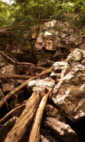
The other day I paid a visit to Slobbery Run, a small stream that cuts down from the hillside on River Road and flows into the canal. It wasn’t very slobbery when I came to visit, but I imagine after a hard rain the water flows a bit more impressively through this rocky valley.
From MacReynolds’ Place Names in Bucks County:
Slobbery Run – Small short steam in southeastern Plumstead Township, tumbling through a rocky ravine about a quarter mile east of Lower Black Eddy and emptying into Delaware Division Canal. The water foams over the rough boulders, hence its name. It is a venturesome climb from Delaware River Road up this steep valley, to be paid upon reaching the top with magnificent waves of river scenery.
It’s located just north of Devil’s Half Acre, an unlicensed distillery that operated along the canal in its early days and acquired a raucous reputation. One of the reasons I visited Slobbery Run was to try to pinpoint the plot of land on the boulder-covered hill that a black farmer cleared and cultivated, which I read about in this article by Cyrus Livezy, published in the Doylestown Democrat on November 28th, 1876, and reprinted by MacReynolds in Place Names:
On the hillside after leaving the old Devils Half Acre house is a modest dwelling erected many years ago by ‘Old Black John,’ who by a vast amount of labor and with more patience and perseverance than is often found in the African race succeeded in rendering a small stony patch susceptible to cultivation, and just beyond this we come to the famous high rocks towering grandly at least eight feet above them. The sun is not visible here and the wintry atmosphere that prevades [sic] this place gives us a taste of that season, and we remember finding a block of winter ice here late April, 1830. Advancing a few rods we pass Rattling Run Cascade and are opposite Moss Giel Rock, which rises from the side of the hill some distance above the road. The ascent is very steep and the distance from the road to the summit of the rock is about three hundred feet. Our fraternal guide offers to lead us up by a circuitous route without difficulty, but climbing steep hills was a favorite amusement fifty years ago, and we resolve to have a taste of it now and in a few minutes, panting for breath, the summit of the rock is reached. Here after resting awhile we contemplate the scenery below, around and far away. On the eastern side is the cascade, so called from a small steam of water flowing through a wildwood glen and over a ledge of rocks. The run formerly bore a name that was rather uncongenial to modern refinement and was changed a few years ago to suit the taste of some Philadelphia ladies; and, although we are generally disposed to accept names as we find them, beg leave to demur on this case (as the steam flows through a thickly wooded glen) to call it Sylvan Run and Sylvan Run Cascade. Moss Giel Rock was dedicated by an ederly [sic] gentleman and some schoolboy companions in 1865, the ceremony consisting of reading Bayard Taylor’s account of the great Burns Festival at Moss Giel in Scotland in 1845. The Broad surface of the rock is smooth and pretty well covered with inscriptions by numerous visitors. Although many years of our life were passed within two miles of this place, we never stood upon the rock before and knew not of its sublimity. To the eastward the head of the Delaware and Raritan Canal feeder, Readings Hollow, Bulls Island and Raven Rock are visible.
It’s amazing to me that, following the rules of politeness in that era, Livezey dances around the word “slobbery” but doesn’t think twice before dropping offensive racial stereotypes.
I didn’t have much luck, and I have no idea if any evidence remains of this old homestead. I looked at an 1876 map of Plumstead, and it seems like the land at the top of the ridge was one large plot, while there were a couple thin strips of separately owned land running between the hill and the canal, one including Devil’s Half Acre and the other with one building shown across the road. It’s possible that John lived there, and that before River Road was widened he had enough cultivatable land to subsist on. I also haven’t been able to identify any African Amercian named John on the Plumstead census records from this era.
UPDATE: I met the owner of what is probably John’s homestead. The old house is gone, but until the 1930’s, it was an old wooden shack raised up on stilts. When the homeowner tore down the house that replaced it (a confused jumble of additions and alterations cobbled together as a residence) to build a new home, the bases of the old wooden stilts were still visible. There’s a small flat area adjacent to the house big enough for a garden. The other houses immediately past Devil’s Half Acre weren’t built until after World War II, and are therefore unlikely candidates for John’s home site.
The owner of John’s plot also told me that, rather than Slobbery Run, the old-timers used the name Sloppy Gulch.